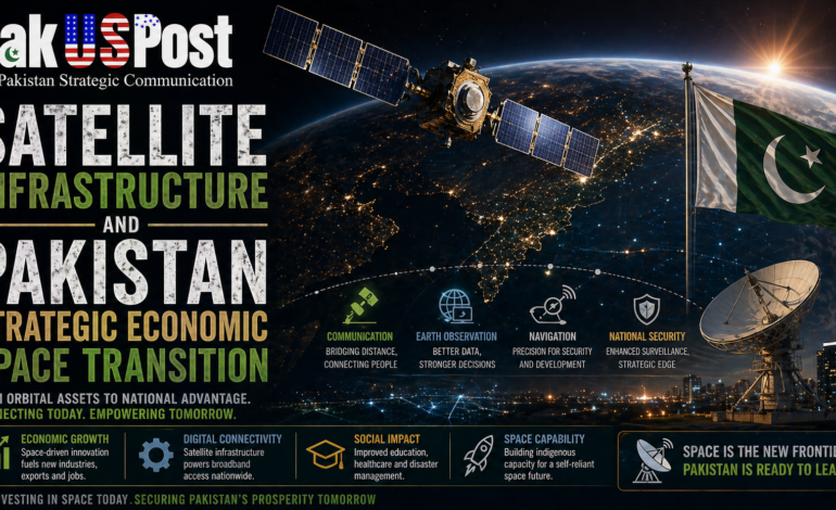
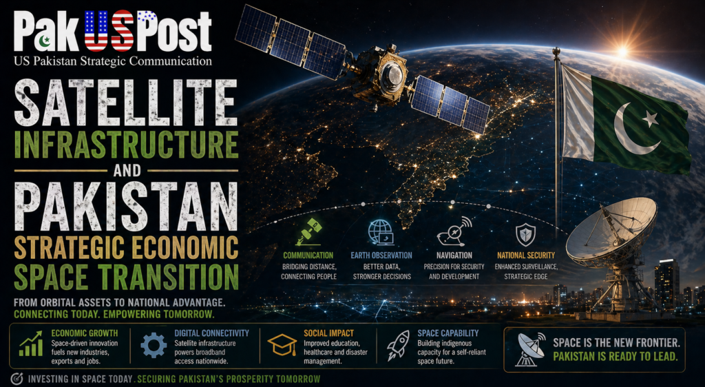
Satellite Infrastructure and Pakistan Strategic Economic Space Transition
The expansion of satellite infrastructure across Asia, the Middle East and the Indo Pacific is quietly redefining the architecture of modern economic power. What was once treated as an arena of symbolic prestige or scientific ambition has now become a foundational layer of economic competitiveness, national security, climate resilience and digital governance. For Pakistan, this transformation raises a difficult but unavoidable question: whether space capability should continue to be viewed as an aspirational scientific domain or reconfigured as essential economic infrastructure embedded in national planning, disaster management and strategic autonomy.
Across the region, the orbital domain is undergoing rapid densification. India’s growing constellation of earth observation and navigation satellites, China’s expansion of its BeiDou navigation system and remote sensing capabilities, and Gulf state investments in space based data ecosystems are all converging toward a new reality in which satellite systems function as invisible infrastructure layers underpinning terrestrial economies. These systems now influence precision agriculture, border surveillance, urban planning, shipping logistics, financial synchronization and climate modelling. The result is a shift from space as exploration to space as infrastructure utility.
Pakistan’s current position in this evolving landscape is constrained but not irrelevant. Its national space agency has maintained a modest presence in satellite development and remote sensing, yet the scale remains limited relative to regional peers. More critically, satellite data integration into national economic planning remains fragmented. Agriculture, water resource management, disaster response and urban expansion continue to rely heavily on outdated data collection methods, even as satellite derived analytics become globally standard in predictive governance systems.
The strategic implication of this gap is profound. In an era of climate volatility, satellite based monitoring is no longer optional. Flood prediction, glacier melt tracking, drought forecasting and crop yield estimation increasingly depend on continuous earth observation data. For a country like Pakistan, which is structurally vulnerable to climate induced shocks, satellite infrastructure is effectively equivalent to early warning systems for economic survival. The floods of recent years have already demonstrated the limits of reactive disaster management. Satellite enabled predictive systems could fundamentally alter the temporal logic of governance from response to anticipation.
At the same time, satellite infrastructure is increasingly intertwined with geopolitical competition. Navigation systems, communication satellites and earth observation networks are not neutral technologies. They are embedded within strategic architectures that determine data access, signal reliability and operational sovereignty. Dependency on external satellite systems introduces vulnerabilities in scenarios of geopolitical tension, where access to positioning systems or high resolution imagery can be restricted, degraded or selectively filtered.
Within the Pakistan United States strategic context, satellite dependency intersects with broader concerns about technological alignment and strategic autonomy. While cooperation in space technology has historically been limited and episodic, the broader global environment is shifting toward a more competitive model of space governance. Export controls, dual use restrictions and security classifications increasingly shape access to satellite technology and related data systems. For Pakistan, this means that reliance on external providers for critical spatial data introduces long term structural risk.
Simultaneously, China’s expanding space infrastructure offers alternative pathways for collaboration, particularly in remote sensing and communications satellites. However, such alignment also embeds Pakistan within a different technological ecosystem, one that is itself part of a broader strategic rivalry between major powers. The result is a constrained choice architecture rather than open technological autonomy. Pakistan’s space policy therefore operates within a narrow corridor defined by competing external systems rather than fully sovereign design space.
The economic implications of satellite infrastructure are often underestimated. Modern economies increasingly rely on geospatial intelligence for supply chain optimisation, infrastructure development and resource allocation. Logistics companies use satellite tracking to reduce inefficiencies, insurance sectors use earth observation data to assess risk, and financial markets integrate satellite derived indicators into commodity forecasting. Without access to high quality spatial data, economies risk falling behind in productivity and planning accuracy.
In Pakistan’s case, agriculture remains the largest sector of employment and a critical component of GDP. Yet agricultural productivity is highly sensitive to climatic variation, water availability and soil conditions, all of which can be monitored with increasing precision through satellite imagery. The absence of fully integrated satellite driven agricultural planning represents a structural inefficiency rather than a technological limitation. The issue is not only access to satellites but institutional capacity to translate data into policy action.
Urbanisation presents another domain where satellite infrastructure is becoming essential. Rapid and often unplanned urban expansion in major Pakistani cities has created challenges in housing, transportation, water management and environmental sustainability. Satellite based mapping and monitoring systems could provide continuous data streams to support smarter urban governance. However, this requires integration between space agencies, municipal authorities and national planning bodies, which remains limited.
The media narrative surrounding space in Pakistan continues to oscillate between episodic celebration of satellite launches and general neglect of spatial infrastructure as a policy domain. Unlike in countries where space programs are integrated into economic discourse, in Pakistan the sector is often framed as symbolic achievement rather than systemic utility. This narrative framing limits public understanding of space as infrastructure and reinforces the perception of it as an elite scientific domain disconnected from everyday governance.
Globally, however, the narrative is shifting decisively. Space is increasingly being described in economic terms rather than exploratory ones. Satellite constellations are now compared to highways, fibre optic cables and power grids. This shift reflects a broader transformation in how infrastructure is defined in the digital age. Infrastructure is no longer purely physical; it is informational, orbital and computational.
For Pakistan, rethinking satellite capability as economic infrastructure would require a fundamental reorientation of policy priorities. First, satellite data acquisition would need to be integrated into national statistical systems. Second, public sector institutions would require capacity building in geospatial analytics. Third, partnerships with private sector firms specializing in satellite imagery and data interpretation would need to be institutionalised. Finally, regulatory frameworks would need to ensure secure and equitable access to spatial data across sectors.
Energy and fiscal constraints remain significant barriers. Satellite development and data processing require substantial investment, long term planning and technical expertise. However, not all solutions require indigenous satellite manufacturing. Increasingly, commercial satellite data is available through international providers, suggesting that the immediate challenge is not ownership of satellites but integration of satellite data into governance systems.
There is also an emerging opportunity in the form of regional cooperation. South Asia and adjacent regions face shared challenges in climate change, water distribution and disaster management. A regional satellite data sharing framework could provide collective benefits, though political tensions have historically limited such cooperation. Nevertheless, the growing frequency of climate induced disasters may create pressure for pragmatic data sharing arrangements even in the absence of broader political alignment.
Within the Pakistan United States policy environment, satellite infrastructure intersects with climate diplomacy, disaster resilience cooperation and technological assistance frameworks. The United States maintains advanced earth observation capabilities that are increasingly used in global humanitarian response systems. Engagement in this domain could provide avenues for technical cooperation even amid broader strategic divergence.
At a deeper level, satellite infrastructure forces a reconsideration of how sovereignty is defined in the twenty first century. Traditional notions of territorial sovereignty are increasingly supplemented by data sovereignty, atmospheric sovereignty and orbital awareness. States that lack access to spatial intelligence risk operating with incomplete situational awareness of their own territory. In this sense, sovereignty becomes partially dependent on visibility from space.
Pakistan’s strategic challenge is therefore not only to acquire satellite capability but to integrate spatial intelligence into the cognitive architecture of the state. This requires institutional reform, technological investment and narrative transformation. Space must move from the margins of policy imagination to the centre of economic and security planning.
Ultimately, the satellite state question is not about prestige or symbolism. It is about whether a country can see itself clearly enough to govern effectively. In an era where visibility from orbit increasingly determines economic efficiency, disaster resilience and strategic autonomy, the ability to interpret and act upon satellite derived data becomes a core function of modern statehood. For Pakistan, the choice is no longer whether space matters, but whether it can afford not to treat space as infrastructure.
A Public Service Message